Thursday, December 19, 2019

Alameda Three Bridges Grand Street to High Street

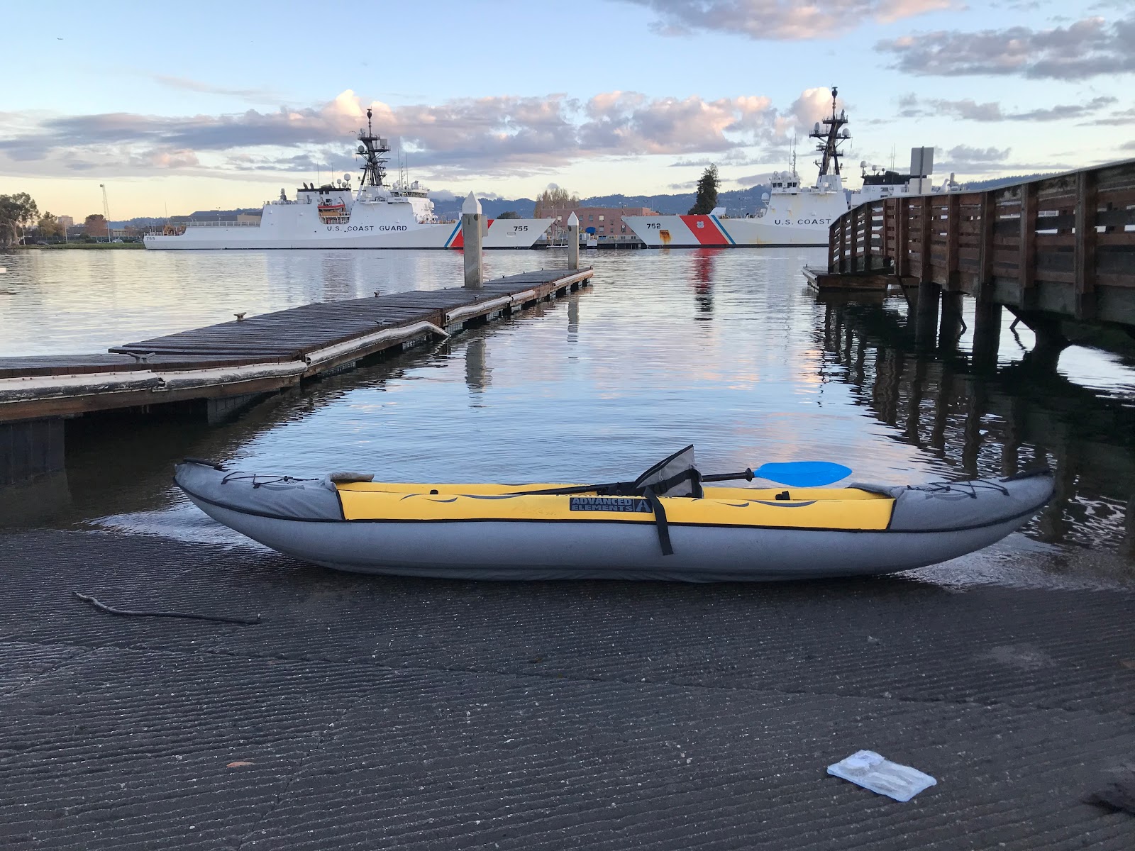
Paddled from the Grand Street boat launch to Channel mark 1 just past the High street bridge.

The paddle back was against a 1knot flooding current and there was no wind.

The round trip took about 2 hours.  Starting at 3p.m., I got back just after sunset.  Need to make sure to bring the lights next time.


Google Album is online here:  https://photos.app.goo.gl/uAi5Pns3emQgdi6KA

Sunday, December 15, 2019

Antioch - Delta San Joaquin River

I visited the area the day before and it was too windy.  There were white caps on the river and I decided it was a bit too risky for my first trip to the area.  I scouted launches around Brennan Island and Antioch on Saturday and decided to come back on Sunday when the wind and weather was predicted to be better.


The boat ramp has a jet ski haul out that worked for landing the kayak.  Taking off from the boat launch is convenient for  access to fishing.  There were a few fishing kayaks going out of this launch.


There were a few fishing boats going out from the boat launch.  Lots of people fishing on the delta.


Paddled up and down the waterfront.  Into the wind was not too bad and downwind was fun.


 Nice day out on the San Joaquin river.  This area gets some heavy winds.  Today it was a light breeze but still choppy.


 Rental kayaks at the Antioch marina ready to go.


SF Bay Water Trails Kayak launch.  Access through the locked gate is needed from the harbor office.


Paddled around the marina to explore.


Headed across the channel to the #5 channel marker.


The opposite side of the San Joaquin river is good habitat for birds.  There is are a lot of wind mills power generation on Sherman island.

Sunday, December 8, 2019

Alameda Point to Alameda Beach


 The boat launch at Alameda Point is a construction project currently.  I was able to launch from the rock wall.  There were other people paddling enjoying the break in the rain from yesterday.


Encinal High School is in the background.  There is also a big construction project at the school.  I have a long history with this location.  This is where I graduated from High School, where I used to launch a Hobbie Cat, where I have caught leopard sharks off the rock wall, where I learned how to sail at the rec center on the former Navy base.  At high tide, with no wind and clear weather, this is a great place to go paddling.


There is a beach to launch inside the rockwall and the boat launch on the opposite side of the rock wall.  I launched from the rocks since the boat launch was closed and I needed to head outside the rockwall towards the SE


There were two person and four person crew boats getting setup to go rowing.


This is the location where the Alameda Community Sailing organization has classes during the Summer.  The outrigger canoe club practices here.


I enjoyed seeing a few harbor seals popping their heads up to check me out.


This was the longest paddle for me yet a couple miles down the beach.  I ended up by Park St. on Alameda Beach landing right before the bird sanctuary wild life refuge.  I packed up the kayak and got a ride back to the Alameda Point boat dock.

Link to the picture album on Google:  https://photos.app.goo.gl/xEo8sgDhDRJwas9F8

SF Bay Water Trails page:  http://sfbaywatertrail.org/trailhead/encinal-beach/
Site Report:  http://sfbaywatertrail.org/wp-content/uploads/2017/10/EncinalBeach_WaterTrailSiteReports_Sept2017.pdf

Thursday, December 5, 2019

Elkhorn Slough Moss Landing


 This is the Advanced Elements StraitEdge2.  Another good deal from craigslist direct from the manufacturer used for a demo unit.  Capable of fast moving rivers and self bailing water that gets into the kayak.  This kayak was a little tricky figuring out tracking in the currents and wind. This was the first time for this kayak on the water and I 'm still learning.


This is one of the best places to see Sea Otters.  Elkhorn Slough has some excellent areas to kayak.  I have wanted to get on the water here for a long time after visiting the area several times to see the otters from land.


They have a lot of kayaks to rent here at the Monterey Bay Kayak Co.  Off Hwy 1 take the North Moss Landing boat launch right before going over the Elkhorn Slough bridge.  I visited the local shop for some advice and better gear. They have tours and classes out of this location that are very popular.  I picked up some wet suit paddling pants and water booties to keep warm when wet.


Arrived about noon and the conditions were great.  Figured out that I had the seat in backwards after spinning around in circles.  Went back to the beach and re-positioned but still didn't have the setup exactly right.  Going with the wind and current, the kayak pulled to the left. 


It rained yesterday and there was a gap in between storm fronts that I felt the need to take advantage of with the newer kayak.


I need some practice with this new kayak to figure out the balance.  Into the wind and waves, it was tracking very well but had problems when going with the current and wind.  Seems like I need to adjust the setup a bit and maybe seating position to get better tracking. It's a huge kayak for one person.  This 500lbs. load limit kayak could hold another person or 100lbs+ of gear and probably get better tracking.   


There were some other paddlers headed for Elkhorn Slough with the Moss Landing power plant in the background.


There were about a half dozen Sea Otters diving for clams in the area.  This one was floating on it's back cracking one open.  They would dive and then pop up near the kayak unexpectedly.  These are one of my favorite marine animals and it was a special day to see them out on the water.

Link to the picture album on Google:  https://photos.app.goo.gl/EKyMT4u7t9EzgTcW7

Elkhorn Slough Kayaking Info:  https://www.elkhornslough.org/recreation/kayaking/

Tuesday, December 3, 2019

Alameda Grand Street Marina


The end of Grand Street in Alameda is a convenient location to launch from the boat launch.  With the short rainy days in December, I need to take advantage of the opportunities between storm fronts for a bit of paddling.


Got out on the water just as the sun was coming up.  There were several crew boats already on the estuary between Oakland and Alameda.  Often, I have sailed here in Friday night sailboat races.  The estuary is one of the best long runs for paddling with shelter from the wind and waves on the bay.


I paddled over to Coast Guard Island and around the mark before heading back.  There was rain the day before and more rain coming so this was a great opportunity to get a few rays of sunshine.


One of the 4 person crew boats passing by the Coast Guard ships.


Picked up a few floating garbage items.  I've filled up many 5 Gal buckets of garbage from the estuary.  There are less floating plastic bags these days but more garbage from the runoff from homeless camps along the estuary in Oakland.


Here is a link to the picture album:  https://photos.app.goo.gl/poNk7MrkMun8einP9

SF Bay Water Trails Info:  http://sfbaywatertrail.org/trailhead/estuary-park/ (Oakland Aquatic Center has a good launch location for the estuary on the Oakland side.)


Sunday, December 1, 2019

Lake Chabot Marina

I checked the Saildrone weather app after waking up to see when it was going to start raining.  It looked like I still had a couple hours to go paddling before the storm front hit.  This gave me enough time to go to Lake Chabot.  There was some big wind gusts happening overnight as the storm approached but the sheltered location of the lake makes it a good choice when other places on the bay are getting blasted by the wind.


The Lake Chabot East Bay Regional Park costs $5 for parking and $2 for the kayak.  There is a required boat inspection done by the local marina attendant that costs $4 for a 30day permit.   The inspection was quick I was out paddling on the lake before the rain started.


There are a lot of rental kayaks, paddle boats, fishing boats and party boats that can be rented out of the marina.


Paddled all the way around the reservoir  in about 1-1/2 hours from the dam around the island to the east end of the lake.  The wind picked up a little and, by the time I got back to the marina, the rain was just starting.  The timing was perfect thanks to accurate weather forecasting.


Next time, I'll bring some water shoes since I took a little dip getting out this time back at the dock.   Not a graceful exit.

Link to the picture album on Google:  https://photos.app.goo.gl/jadrswq8rgziXhwAA

The Lake Chabot Marina website: https://www.lakechabotrecreation.com/

Cal Kayak 2020 Map

Cal Kayak 2020 Map: Link to the Google Map of kayak launch locations.

Saturday, November 30, 2019

Pillar Point Harbor


I arrived at Pillar Point Harbor before sunrise.  Rested in the car waiting for twilight.  It was a breezy morning, overcast with rain clouds on the horizon.


There was no one at the Half Moon Bay Kayak Co where they rent paddling equipment during the summer season.  I enjoyed the easy access to the beach.


I paddled over to where the Half Moon Bay yacht club is located and back against the wind.  I didn't get out of the harbor since the weather was turning and I didn't want to take any chances out on the big blue water.  Maverics and Granada beach surfing will need to wait for a better weather day.


Earlier this year, I went out rock fishing on the Queen Mary out of this harbor.  We caught our boat limit and got some good cod fillets.

Picture album on Google Photos:  Pillar Point Harbor 11-30-19

Link to HMB Kayak Co website:  http://www.hmbkayak.com/

Friday, November 29, 2019

Martin Luther King Regional Shoreline


 The East Bay Regional Park Martin Luther King Regional Shoreline off of Doolittle Drive in Oakland gives access to the San Leandro Bay and estuary.  This channel is close to the Oakland airport and is often used by rowing crews for practice.  The access to the Oakland - Alameda estuary provides for a long paddling run.


Martin Luther King Regional Shoreline Boat Launch Nov 29th, 2019
There is a boat ramp and a dock area that are good for launching the kayak.  The parking lot is conveniently located with easy access.


Be careful when the tide is going out the dock is very slippery.


This was my longest paddle yet.  After an hour my hand started cramping and the wind picked up from the Southwest.  The long fetch and headwind slowed me upwind and helped downwind.  The clouds on the horizon and November chill in the air showed signs of approaching rain.  The morning started out clear and sunny and was cloudy by the time I finished.


There are a few interesting sites besides all of the cars zipping by on Doolittle Dr. and airplanes around the Oakland airport.  The Oakland coliseum and stadium complex are straight across from the boat launch.  The Oakland Airplane Museum is across Doolittle Dr.  I have come here before to watch fireworks before after A's games.  The area has a lot of birds and trails on both sides of the channel.


Thermalito Afterbay Feather River

Thermalito Afterbay, Feather River Nov. 24th, 2019

The Thermalito Afterbay is much larger than the forebay that I visited the day before.   Power boats are allowed for fishing and there were several fishing boats already out fishing when I set out on the kayak.  I brought sandals and insect repellent for this trip.  My toes were a little chilly.


The monument Hill boat launch is right off the 162 freeway coming from Oroville.   The bridge doesn't have a lot of clearance overhead.  Birds nests line the underside of the structure.


It was a little chilly in the morning but still a spectacular day for November.  The view of The Buttes mountains and a variety of birds make this a very nice place to paddle.


I hardly noticed the waves when the wind picked up or fishing boats zoomed by.  I spent about an hour paddling and visited both sides of the bay under the bridge.  There is a lot of area to explore with the outlet to the Feather River near Highway 70.